
WELCOME TO KOZHIKODE, KERALA, INDIA
Kozhikode (Calicut), the most important region of Malabar in yesteryears, was the capital of the powerful Zamorins and also a prominent trade and commerce center.
Kozhikode District found a place in the World History with the discovery of Sea Route to India in 1498 by the Portuguese Navigator Vasco Da Gama. Vasco Da Gama landed at the Kappad sea shore with three vessels and 170 men. A monument is constucted here to commemorate the historical landing.
Kozhikode city continues to be a centre of flourishing domestic and international trade. Its contribution to all round development of the district in trade, commerce and economic development over the years is spectacular.
Hotels In Kozhikode
Find The Perfect Hotels
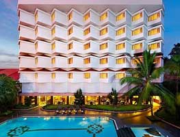
The Gateawy Hotel, Kozhikode
The Taj Residency at Calicut is a business hotel located in the historically significant spice trading town and sea port ...

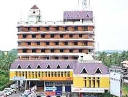
Malabar Palace, Kozhikode
Malabar is a perfect partner for the business traveler with all facilities that you need to make your stay both pleasurable ....
West Way Hotel, Kozhikode
Located in Kerala, Calicut , is an important hub for trading and business. The aesthetically designed West Way Hotel
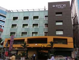
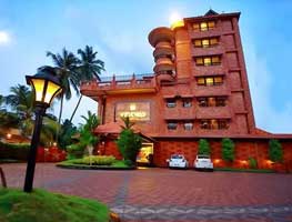
Hotel Hyson Heritage, Kozhikode
Hyson heritage inhabits a distinctive country setting with elegant gracefullness.......
About Kozhikode
Kozhikode city is the marketing centre for commodities like pepper coconut, coffee, rubber, lemon grass oil etc., produced in Kozhikode and the neighbouring districts of Wayanad, Malappuram and Kannur.
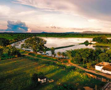
Basking in the idyllic setting of the serene Arabian Sea on the west and the proud peaks of the Wayanad hills on the east, this district with the serene beaches, lush green countryside, historic sites, all combine to make Kozhikode a popular tourist destination filled with a warm ambience to fascinate a visitor
Location :Northern Kerala
What To See :Beaches-Kozhikode, Beypore
Museums- Pazhassirajah,Krishna Menon Waterfalls-Thusharagiri
Religious stuctures-Jama-at-palli,Tali Temple
Sanctuary - Kadalundi Bird Sanctury etc.
Must Taste :Kozhikodan Halwa,
Fame :-The Second Mecca of football lovers -The land of Kalaripayyattu
Climate :Tropical, STD Code :0495, Best Time To Visit :September To May
Topography :Sandy coastal belt, the rocky highlands,lateritic midland
Borders :Kannur district in North, Wayanad, district in East, Malappuram district in South, Arabian Sea on West.
Properties for sale in Kozhikode

Touch Your Number
Dial these numbers for your correct way